The Most Beautiful Places in America: 12 Landscapes Worth Building a Trip Around

There’s a difference between a pretty city and genuinely beautiful places in America, and it usually comes down to who did the design work. Cities get their looks from architects and city planners, but the places on this list didn’t need any of that; they’ve had millions of years and no committee involved at all. This is a list of the natural spots in America that stop people mid-sentence, the ones that show up on every serious traveller’s list for a reason that has nothing to do with marketing and everything to do with just standing there and looking at them.
Twelve made the cut here, spread across deserts, coastlines, mountains and canyons, because America’s beauty was never going to fit into one climate or one kind of landscape. Instead of rushing through all twelve with a line or two each, this guide slows down on every one of them, explaining what makes each place actually worth the drive, when to go, what most visitors miss, and the small details that tend to separate a good trip from a forgettable one.
1. Grand Canyon, Arizona
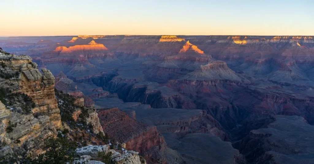
There’s a reason the Grand Canyon shows up first on almost every version of this list, and it’s not just tradition. Nothing quite prepares you for standing at the rim the first time; the canyon stretches 277 miles long and up to 18 miles wide in places, carved by the Colorado River over roughly six million years, and the scale of it genuinely doesn’t translate through photographs the way most landscapes do. The layered rock walls shift colour constantly throughout the day, deep red at sunrise, softer orange by midday, and something close to purple right before dark, and honestly, watching that colour shift happen in real time is a better use of an hour than most of the formal viewpoints get credit for.
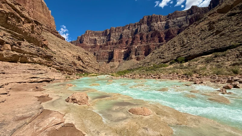
The South Rim gets the vast majority of visitors, and for good reason, it’s the more accessible side, open year round, with a shuttle system that makes hopping between viewpoints painless even without a car. Mather Point and Yavapai Point are the two most crowded spots for sunrise, but walking even a half mile down the Rim Trail in either direction thins the crowd out considerably without sacrificing the view. The North Rim, by contrast, sits about a thousand feet higher, runs noticeably cooler, and closes entirely from mid-October through mid-May due to snow, which keeps visitor numbers to a fraction of the South Rim’s; roughly one in ten visitors ever make it there, and the quieter, more forested approach feels like a genuinely different park.
For anyone with more time, hiking below the rim changes the experience entirely. The Bright Angel Trail and South Kaibab Trail both descend into the canyon itself, and even a few hours down and back gives a sense of scale that no rim viewpoint can match; the canyon walls that looked distant and painterly from above suddenly tower directly overhead. Rafting the Colorado River through the canyon floor, either on a shorter multi-day trip or the full sixteen-day traverse, is considered by a lot of repeat visitors to be the single best way to actually understand the canyon’s geology, since the rock layers exposed along the river represent close to two billion years of the Earth’s history stacked in order.
2. Yellowstone National Park, Wyoming
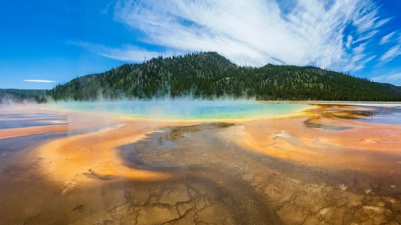
Yellowstone earned its status as America’s first national park back in 1872, and more than 150 years later it’s still one of the strangest, most geothermally active places on the planet. Old Faithful gets the crowds, erupting roughly every 90 minutes with enough predictability to build a schedule around, but the real draw for a lot of repeat visitors is the Grand Prismatic Spring, a hot spring so large and so vividly coloured, deep blue fading into orange and yellow at the edges, that it looks digitally altered even in person. The colours themselves come from heat-loving bacteria living in the mineral-rich water, with different species thriving at different temperature bands, which is why the ring pattern shifts colour the further it gets from the scalding centre.
Beyond the geothermal features, Yellowstone’s 2.2 million acres spread across Wyoming, Montana and Idaho hold some of the best wildlife viewing in the country: bison herds wandering right up to roadways; wolves in the Lamar Valley, often called America’s Serengeti for how reliably predators show up there at dawn and dusk; and elk that show up in the meadows most mornings without much effort required to find them. The park sits atop one of the largest active volcanic systems on Earth, and that geology is exactly why the whole place bubbles, steams and erupts the way it does, with over 10,000 geothermal features in total, more than half of all the geysers on the planet concentrated in this one park.
Traffic and crowding are worth planning around seriously here, since Yellowstone’s road network is limited and summer weekends can mean long waits at wildlife jams – cars stopped in the road because someone spotted a bear. Early morning, before 8am, tends to be both the best wildlife viewing window and the quietest time to see the major geothermal basins before tour buses arrive. Staying inside the park, at Old Faithful Inn or one of the smaller lodges, rather than commuting in from a gateway town each day, makes a genuine difference in how much of the park is actually seeable within a normal trip length.
3. Yosemite National Park, California
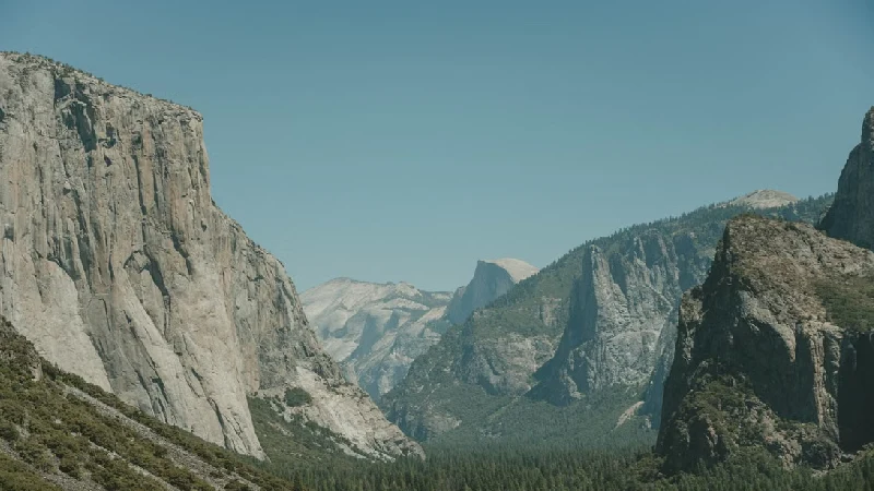
Yosemite Valley is the kind of place that photographers spend entire careers trying to capture properly, with granite cliffs rising thousands of feet straight up; waterfalls that thunder in spring and slow to a trickle by late summer; and sequoia groves with trees older than most countries. El Capitan and Half Dome are the two names everyone knows, massive granite formations that draw climbers from around the world. El Capitan alone rises over 3,000 feet in a single unbroken sheet of granite, considered one of the most difficult and iconic big wall climbs on the planet, but the valley floor itself, meadows framed by those cliffs on every side, is worth the visit even without any hiking involved.
Spring is the best window for waterfalls at full force. Yosemite Falls and Bridalveil Fall are both at their most dramatic when snowmelt is running high, typically April through June before things dry out for summer, and by late August a lot of the smaller falls have thinned to almost nothing, which surprises visitors who show up expecting the postcard version regardless of season. Beyond the valley floor, Yosemite holds far more than most first-time visitors realise; Tuolumne Meadows offers a completely different high-country alpine landscape reachable by the seasonal Tioga Road, and Mariposa Grove protects some of the largest giant sequoias on Earth, trees that were already centuries old when the park was first established.
Permits have become a genuine part of planning a Yosemite trip in recent years, both for popular hikes like Half Dome, which requires a separate cable permit during peak season, and in some cases for entry to the valley itself during the busiest summer weekends, so checking current requirements before locking in dates matters more here than at most other parks on this list. The valley’s relatively small footprint, easy to walk or bike between major viewpoints, is part of what makes it feel so immersive despite the crowds; very few national parks let you get this close to formations this large on foot.
4. Zion National Park, Utah
Zion’s beauty comes from contrast, deep red and cream-coloured sandstone cliffs rising straight out of a narrow green valley, with the Virgin River cutting through the bottom the whole way. The Narrows, a hike that involves walking directly through the river between canyon walls that in places are close to just twenty feet apart, is one of the more unusual hikes in the entire national park system, wading through knee- to waist-deep water with thousand-foot walls rising on either side, and Angels Landing, a narrow ridge trail with chain handholds bolted into the rock, has become one of the most sought-after permits in the country, drawing far more applicants each season than the trail can safely handle.
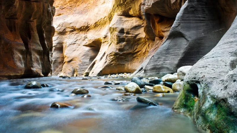
Even without doing either famous hike, the drive through Zion Canyon on the shuttle, red rock walls closing in on both sides, gives most visitors a legitimate sense of the scale here in under an hour. Private vehicles are restricted from the main canyon road for most of the year, which keeps the whole corridor quieter and less congested than it would otherwise be given how popular the park has become, and the shuttle stops line up conveniently with most of the shorter, family-friendly trails like Emerald Pools and Weeping Rock.
The Narrows itself deserves a bit more detail, since it’s genuinely different from a normal trail hike. There’s no maintained path; the riverbed is the trail, and conditions change based on water flow, which means checking current flash flood risk before setting out is a real safety step rather than a formality, the canyon’s narrow walls mean a storm miles upstream can raise water levels dangerously fast with very little warning at the hike’s location. Renting a walking stick and water shoes at one of the outfitters near the park entrance makes the hike considerably more manageable than attempting it in regular sneakers.
5. Antelope Canyon, Arizona
Antelope Canyon operates on a completely different visual register than anywhere else on this list, a slot canyon carved by flash flooding over thousands of years into smooth, wave-like sandstone walls that curve and twist overhead. Upper Antelope Canyon is the more famous of the two sections, largely because it’s where the light beams that made this place internet-famous shine down through narrow openings, typically visible from late spring through summer around midday, when the sun sits high enough to reach the canyon floor directly.
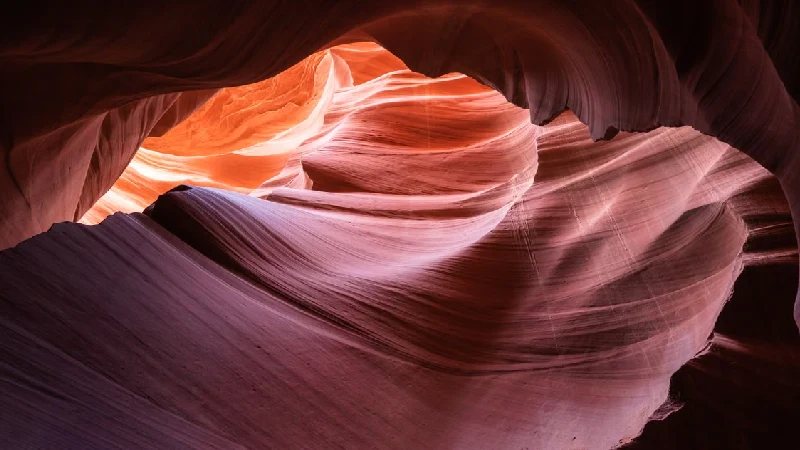
Access here works differently than a typical national park too; the canyon sits on Navajo land, and visits require a guided tour booked through a Navajo-owned operator, which is worth knowing well ahead of a trip since the popular tour slots, especially the midday light beam tours, fill up weeks or even months in advance during peak season. Lower Antelope Canyon, less visited than the upper section, involves more ladders and a narrower, more physically demanding route but rewards visitors with fewer crowds and arguably more dramatic curved rock formations since the canyon here is deeper and twists more sharply.
Photography rules have tightened considerably over the years; tripods are restricted or banned on most standard tours now, largely because the canyon’s popularity outgrew what a narrow slot canyon can comfortably handle with tripod-carrying visitors trying to set up shots. Beyond Antelope Canyon itself, the surrounding area holds other slot canyons worth knowing about; Canyon X and Cathedral Canyon nearby draw far smaller crowds while offering a similar experience, worth considering for anyone who finds the main canyon’s tour groups too crowded for the kind of quiet, contemplative visit these formations seem to invite.
READ MORE: UK Theme Parks Ranked – Best for Every Age Group Honestly
6. Glacier National Park, Montana
Glacier earned the nickname ‘the Crown of the Continent’ for good reason, with jagged mountain peaks, more than 700 lakes, and the Going-to-the-Sun Road, a 50-mile stretch widely considered one of the most scenic drives in the entire country, climbing over the Continental Divide with turnouts that practically demand you stop the car every few miles. The road itself is an engineering feat as much as a scenic route, carved directly into mountainsides in the 1930s, and it typically only opens fully by late June or early July once snow removal crews clear the higher sections, which is worth checking before planning a spring trip specifically around driving it.
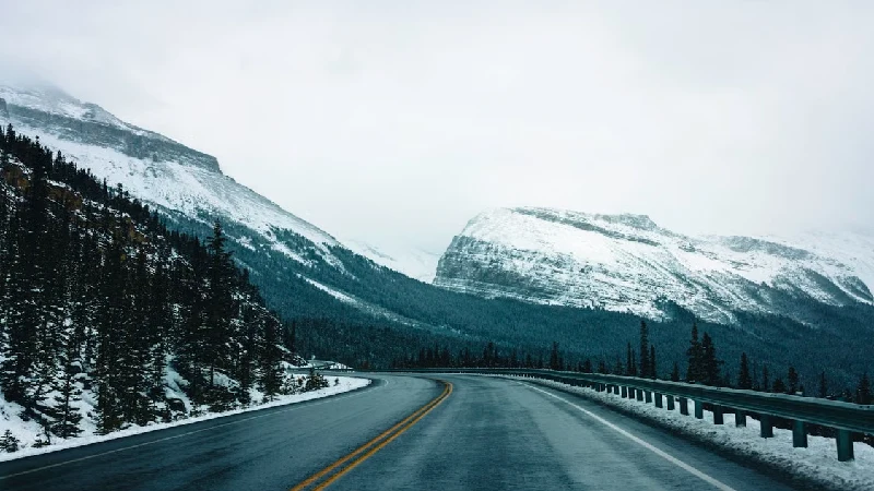
The park’s namesake glaciers are retreating faster than most visitors realise. Of the roughly 150 glaciers present when the park was established in 1910, only a small fraction remain today at a size that still technically qualifies as a glacier, which has quietly turned a visit here into something closer to a bucket list item with a shrinking timeline. Grinnell Glacier, reachable by a strenuous but well-marked day hike, remains one of the more accessible glaciers left in the park and gives a genuine sense of what’s being lost as the ice continues retreating year over year.
Lake McDonald, the park’s largest lake, is worth a stop on its own, with colourful rocks visible beneath crystal-clear water that stays that way regardless of how many visitors pass through each summer; the lake’s clarity comes from the surrounding glacial geology filtering the water naturally. Beyond the main road corridor, Glacier’s backcountry, requiring permits for overnight trips, holds some of the least crowded genuine wilderness left in the lower 48 states, and even a single night camped near one of the high alpine lakes gives a completely different sense of the park than a day spent driving the main route.
7. Acadia National Park, Maine
Acadia sits mostly on Mount Desert Island off the coast of Maine, and it was recently named the most beautiful place in America on Condé Nast Traveller’s list of the country’s most jaw-dropping destinations, a ranking that makes sense the moment you’re standing on its granite coastline watching waves break against pink-tinted rock. The park packs mountains, dense woodland and rocky Atlantic shoreline into just 47,000 acres, a genuinely small footprint compared to the sprawling western parks on this list, which makes it one of the more manageable parks to see thoroughly even on a shorter trip.
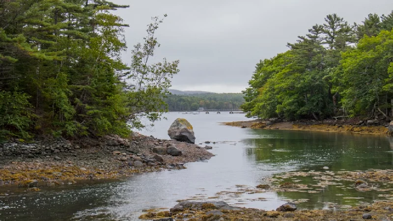
Cadillac Mountain within the park is famously one of the first places in the entire country to see the sunrise for part of the year, between early October and early March specifically, which has made pre-dawn drives to the summit something of a ritual for visitors willing to set an alarm for it. The Park Loop Road connects most of the park’s major sights in a single scenic drive, and Jordan Pond, with its still, reflective water and the distinctive twin peaks known as the Bubbles rising behind it, has become one of the most photographed spots in the park, especially paired with popovers at the historic Jordan Pond House restaurant, a tradition dating back over a century.
Fall foliage season here, typically early to mid-October, layers vivid red and orange maple and birch trees against the granite and ocean backdrop, and it’s genuinely one of the better foliage displays anywhere on the East Coast, drawing a different, quieter crowd than the summer beach-and-hiking visitors. The park’s carriage roads, built and gifted by John D. Rockefeller Jr. in the early 1900s, offer nearly 45 miles of car-free gravel paths for biking and walking, crossing a series of elegant stone bridges that are worth seeking out on their own even outside the park’s more famous viewpoints.
8. Great Smoky Mountains National Park, Tennessee and North Carolina
The Smokies hold the distinction of being the most visited national park in the country by a wide margin, drawing more annual visitors than the Grand Canyon and Yellowstone combined, and the beauty here is quieter than the dramatic peaks out west, with rolling blue-tinted mountains, dense old-growth forest, and a haze that gives the range its name, caused by natural organic compounds released by the trees themselves, which scatter light in a way that produces that distinctive soft blue tint over the ridgelines. Spring brings wildflower blooms across the valley floors, with the park hosting well over 1,500 flowering plant species, more than almost any other national park in the country, while fall turns the entire range into a rolling wave of colour from ridge to ridge.
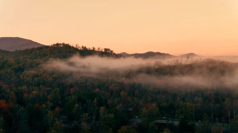
Cades Cove, a wide valley ringed by mountains and dotted with historic log cabins, churches and a working grist mill preserved from the area’s Appalachian settler history, is one of the more accessible spots in the park for wildlife viewing; black bears, deer and wild turkeys show up regularly along the 11-mile loop road there, particularly around dawn and dusk when animals are most active and traffic tends to be lightest.
Unlike most national parks, the Smokies charge no entrance fee, a condition tied to the original land deed from when the park was established in the 1930s, which is part of why visitor numbers here run so high relative to other parks of similar size. The park straddles the border between Tennessee and North Carolina, and the two sides offer noticeably different experiences: the Tennessee side near Gatlinburg leans more developed and tourist-orientated, while the North Carolina side around Cherokee tends to feel quieter and more rural, which is worth knowing when deciding which entrance to base a trip around.
9. Grand Teton National Park, Wyoming
Just south of Yellowstone, the Tetons offer a different kind of drama, with jagged peaks that rise abruptly out of the valley floor with essentially no foothills to soften the transition, which makes them look taller and sharper than their actual elevation would suggest. The range rises more than 7,000 feet above the valley floor in places, one of the most dramatic vertical rises of any mountain range in the country. Jenny Lake, sitting directly beneath the range with the peaks reflected in still water on a calm morning, is the single most photographed spot in the park, and for good reason; a short boat shuttle across the lake also cuts out several miles of otherwise flat approach hiking toward Hidden Falls and Inspiration Point.
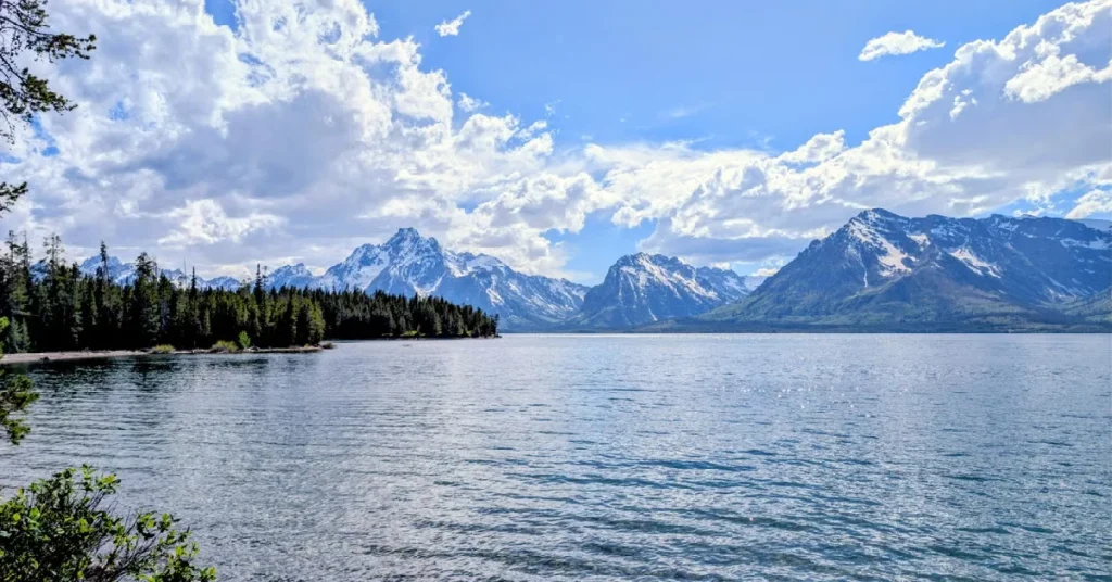
Wildlife here rivals Yellowstone too; moose are a common sight along the willow flats near the Snake River, and the whole park works well as a quieter, less crowded add-on for anyone already routing through Yellowstone. The two parks connect directly via a short scenic drive, making a combined trip through both one of the more efficient ways to see two very different landscapes back to back. Mormon Row, a historic homestead area within the park featuring weathered wooden barns set directly against the mountain backdrop, has become one of the most photographed pieces of Americana in the entire national park system, especially at sunrise when the barns silhouette against the peaks.
Floating the Snake River, either on a calm scenic float or a more active whitewater stretch further downstream, gives a completely different vantage point on the range than any of the road viewpoints, and it’s worth booking through one of the local outfitters based in Jackson if a full day isn’t available, since even a shorter half-day float covers some of the best mountain views in the park.
10. Na Pali Coast, Kauai, Hawaii
The Na Pali Coast is one of the few places on this list that’s genuinely difficult to access; no roads reach most of it, and that isolation is exactly why it’s stayed this dramatic. Sheer green cliffs, some rising over 4,000 feet directly from the Pacific, stretch along roughly 17 miles of coastline, carved by millions of years of wave action and rainfall against the island’s volcanic rock, and the only ways to see it properly are by boat, helicopter, or the demanding Kalalau Trail for experienced hikers willing to commit to a multi-day permit hike.
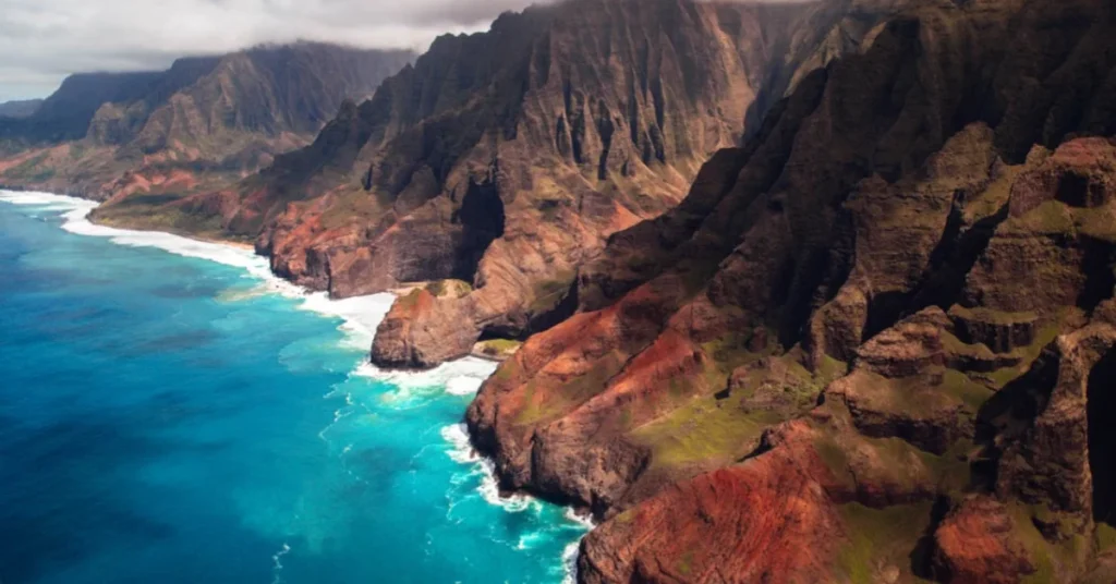
A sunset boat tour along the coast tends to be the most realistic option for most visitors, and the cliffs turn a deep gold in the last hour of daylight in a way that’s hard to overstate until you’ve actually seen it. Most tours also pass sea caves and, depending on the season, offer a real chance of spotting spinner dolphins or, during winter months roughly December through April, migrating humpback whales offshore. The Kalalau Trail itself, considered one of the most dangerous and rewarding hikes in the entire national park system despite technically falling under state park management, covers 11 miles one way along narrow, exposed cliffside sections, and a permit system strictly limits how many hikers can attempt the full route to Kalalau Beach on any given day.
Helicopter tours, while considerably more expensive than a boat trip, offer the only realistic way to see the full length of the coast in a single outing, including remote interior valleys completely inaccessible by trail or boat, and for travellers with limited time on the island, it’s often the most efficient way to genuinely take in the scale of the coastline rather than piecing it together from a handful of accessible viewpoints.
11. Big Sur, California
Big Sur isn’t a single site so much as a 90-mile stretch of California’s Highway 1 where the Santa Lucia Mountains drop almost straight into the Pacific, and the drive itself is the destination for a lot of visitors. Bixby Bridge, a graceful concrete arch spanning a coastal canyon and completed in 1932, is the most photographed stop along the route, its clean single-span design considered one of the tallest single-span concrete bridges in the world at the time it was built, while McWay Falls, an 80-foot waterfall that drops directly onto a beach, gives Big Sur one of the more unusual waterfall settings anywhere in the country, a rare case of a year-round waterfall meeting the ocean directly rather than a river.
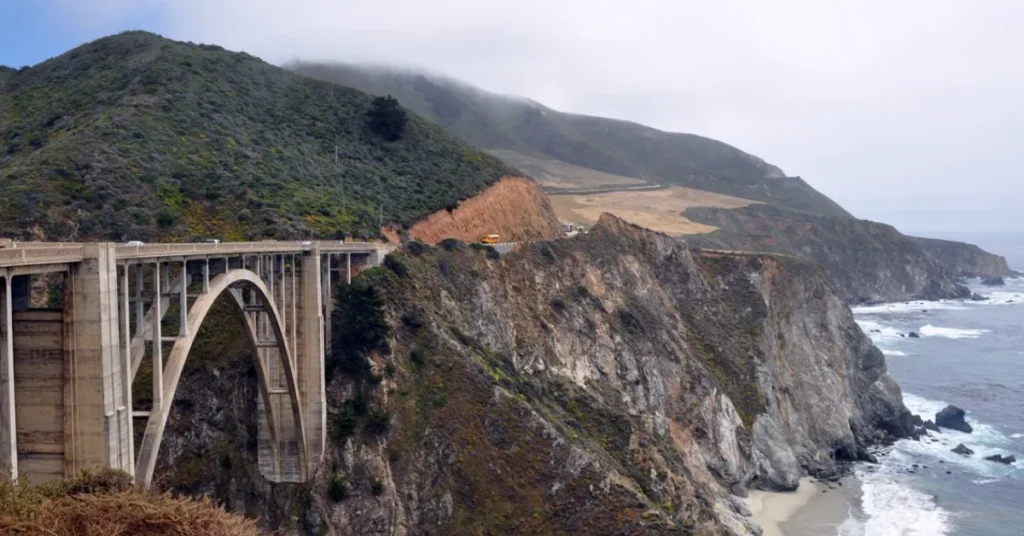
Fog is a genuine part of the Big Sur experience rather than a nuisance to plan around, mornings often start socked in before burning off by early afternoon, and honestly, the moody version of the coastline has its own kind of beauty that clear skies don’t quite replicate, a lot of photographers specifically time visits around the marine layer for exactly that reason. Beyond the two most famous stops, Pfeiffer Big Sur State Park holds redwood groves just a short walk from the coastal highway, an odd but striking pairing of towering ancient trees and ocean cliffs within minutes of each other, and Julia Pfeiffer Burns State Park, home to McWay Falls, also offers quieter beach coves further from the main pullouts.
Highway 1 itself remains genuinely vulnerable to landslides and closures; sections of the road have washed out or closed for extended repairs multiple times in recent years, so checking current road conditions before a trip is a practical necessity here rather than an optional precaution, unlike most of the other drives on this list.
12. Great Sand Dunes National Park, Colorado
Great Sand Dunes holds the tallest sand dunes in North America, some rising more than 750 feet, sitting improbably at the base of the Sangre de Cristo Mountains in southern Colorado, with snow-capped peaks directly behind rolling desert dunes in a combination that looks like two different landscapes got merged by mistake. The dunes formed over roughly 440,000 years, sand blown in from the San Luis Valley floor and trapped against the mountain range, and the park protects not just the dune field itself but surrounding grasslands, wetlands and alpine tundra, making it one of the more ecologically varied parks on this list despite the dunes getting most of the attention.
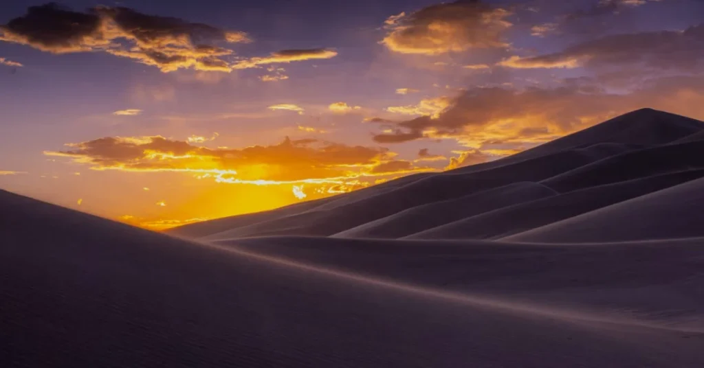
Climbing the dunes at sunrise or sunset, when the sand shadows deepen and the temperature drops out of the punishing midday heat, is the way most visitors say the park is meant to be experienced; midday sand surface temperatures can reach well over 140°F in summer, making the climb genuinely uncomfortable and even risky without proper footwear during peak afternoon hours. Sandboarding and sand sledding have become popular activities on the dunes, using specialised boards rented from outfitters near the park entrance, since regular snowboards and sleds don’t hold up well against the abrasive sand.
Medano Creek, which flows at the base of the dunes each spring depending on snowmelt, adds a strange and genuinely fun element most visitors don’t expect: wading through a shallow creek with sand dunes rising directly behind it, and the creek even produces a natural surge flow effect in late spring, with small waves pulsing rhythmically downstream, caused by sand build-up temporarily damming and releasing the water, a phenomenon rarely seen anywhere else in the country.
What Makes These Places Different From A Pretty City
Natural beauty on this scale runs on a different clock than architecture. A city can be rebuilt, restored, or redesigned within a generation, but a canyon carved over six million years or a glacier that’s been retreating for over a century operates on a timeline no amount of city planning can replicate. That’s part of what makes these places feel different to stand in; there’s a genuine sense that you’re looking at something that took far longer to make than any structure ever could and that it’ll keep changing long after the trip is over, whether that’s a glacier continuing to shrink or a dune field slowly reshaping itself with every windstorm.
Best Time To Visit Each Region
Timing shifts a lot depending on which of these places is on the itinerary. The Grand Canyon, Zion and Antelope Canyon are all best visited in spring or fall, March through May or September through November, avoiding both summer’s brutal desert heat and winter road closures on the higher-elevation routes. Yellowstone and Grand Teton peak in summer, June through August, when all roads are open and wildlife is most active, though September brings smaller crowds and the start of fall colour, along with the added bonus of elk rut season, when bull elk bugle loudly across the valleys to attract mates. Yosemite rewards a spring visit for waterfalls at full force, while Acadia and the Smokies are both at their best in fall, typically late September through mid-October, when foliage peaks. Hawaii’s Na Pali Coast and California’s Big Sur both work well nearly year-round, though winter brings rougher seas that can limit boat access to the Na Pali cliffs specifically, while also being prime whale-watching season for the same coastline. Great Sand Dunes is genuinely a year-round destination in its own right: spring for the creek flow, fall for cooler dune-climbing temperatures, and even winter for the unusual sight of snow dusting the tops of the dunes against the desert landscape below.
Final Thoughts
Ranking natural beauty is always going to be a little bit unfair; comparing a desert slot canyon to a coastal cliffline in Hawaii is really comparing two completely different kinds of impressive, but these twelve keep earning their spots on serious travel lists for reasons that go well beyond a good photo angle. Some, like the Grand Canyon and Yellowstone, have had well over a century to build their reputations, backed by the full weight of the National Park Service and generations of visitors returning again and again. Others, like Antelope Canyon, went from a local secret to an internet phenomenon within the last couple of decades, and still others, like the Na Pali Coast, remain genuinely hard to reach even now, which is arguably part of why they’ve stayed this beautiful in the first place. Either way, this is a solid starting list for anyone building a US trip around the places that genuinely earned their reputation the hard way, with time, geology, and absolutely no help from an architect.