California Pacific Coast Highway Road Trip Guide 2026: Route, Stops, And What’s Actually Open

For almost three years, the most famous stretch of the Pacific Coast Highway had a gap in the middle of it. A landslide in January 2023 closed part of Highway 1 near Big Sur. More slides followed. Drivers could reach Big Sur from the north or the south, but they couldn’t drive straight through. If you planned a classic San Francisco to Los Angeles road trip, you took a long detour inland.
That’s over. Caltrans reopened the last closed section, a 6.8-mile stretch at Regent’s Slide, on 14 January 2026. Highway 1 now runs end to end again. So 2026 is a good year to do this drive.
It’s not a carefree year, though. The road has a habit of closing for rain, rockfall, and wildfire. One of the best-known viewpoints has been under repair. And it’s easy to plan a trip that looks great on a map and falls apart on the ground. So this guide covers the route, but it also covers what to check, what to book early, and what to skip.
The Quick Facts
- The drive from San Francisco to Los Angeles is roughly 450 to 500 miles on Highway 1.
- You can drive it in two long days. Most people need four to six to enjoy it.
- Southbound is the better direction. You’re on the ocean side of the road.
- There are no tolls on the highway itself.
- The best windows are late April to early June, and September to early October.
- Check Caltrans road conditions the morning you drive. Every time.
Is Highway 1 Actually Open?
Yes, with a few caveats. The through-route reopened on 14 January 2026. That ended the longest sustained closure in Big Sur’s history.
But “open” on this road never means “guaranteed”. Winter storms can close sections again. In mid-February 2026, a 6.8-mile stretch near Regent’s Slide closed for a while after rain washed debris into the catchment area at the base of the slope. Caltrans says the slope itself stayed stable, but cleanup after storms is part of life here now.
Wildfire is the other risk. Fires closed parts of Highway 1 in Big Sur in the autumn. At the time of writing in early October 2026, the road had reopened, and the Monterey tourism board reported travel between Cambria and Carmel through Big Sur was possible again. Fire operations were still continuing nearby, though. There are also overnight closures planned for 12 to 15 October, from 11pm to 5am, just north of Point Sur Lighthouse. If you’re driving at night, that matters.
So here’s the rule. Before you leave your hotel each morning, open the Caltrans QuickMap and check Highway 1. Then check the Monterey County travel alerts page for fire and road updates. It takes two minutes. It has saved a lot of people from a three-hour detour.
When To Go
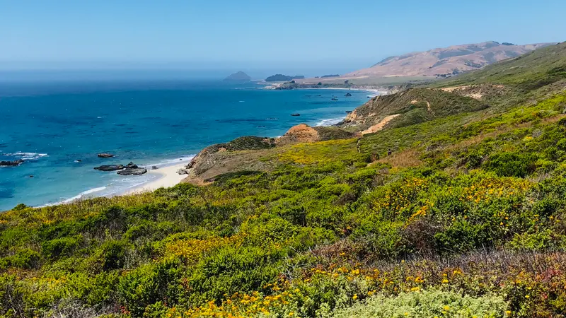
Late April through early June is the sweet spot. Wildflowers are out, the morning fog usually burns off by late morning, and summer crowds haven’t filled the parking at Bixby Bridge yet.
September and early October come close. The evenings are warm in Santa Barbara, school-holiday families have gone home, and the light on the coast turns golden. The catch is fire season, which is why checking conditions matters so much in autumn.
Summer is busy and foggy. Coastal fog is common in the mornings, and it can hide the very views you came for. Hotels and campgrounds along Big Sur fill up weeks, sometimes months, ahead.
Winter is quiet, and it can be beautiful. It’s also the season when storms close the road. If you go between December and March, keep your itinerary loose and have a plan B inland.
Which Direction, And How Many Days
Drive south, San Francisco to Los Angeles, if you can. On a southbound drive, the ocean is on your side of the road. That makes it much easier to pull into the scenic turnouts, and you don’t have to cross traffic to do it. You can drive it the other way, and many people do, but the pullouts are a pain.
How many days depends on your patience:
- Two to three days. Doable, but it’s mostly driving. You’ll see Big Sur through the windscreen.
- Five days. The comfortable version. You average about 100 miles a day, with time for walks, meals, and a lot of photo stops.
- Seven days or more. The slow version, with a night in Monterey or Carmel, two in Big Sur, and time for Santa Barbara.
Here are the main distances. San Francisco to Monterey is around 120 miles, about two and a half hours. Monterey to Santa Barbara is around 240 miles, and it takes five hours or more on Highway 1 because of the slow, winding road. Santa Barbara to Los Angeles is about 95 miles. The famous Big Sur stretch, between Carmel and San Simeon, is roughly 90 miles. Don’t judge it by the mileage. It takes hours.
The Route, Stop By Stop
San Francisco To Santa Cruz
Leave the city early and take Highway 1 south through Half Moon Bay. It’s a short, easy warm-up. You’ll pass farm stands, beaches, and pumpkin fields in autumn. Santa Cruz is a good lunch stop, with its old boardwalk and surf scene. It’s also a decent place to stretch your legs before the slower roads ahead.
Monterey And Carmel-By-The-Sea
This is the gateway to Big Sur and a great first night. The Monterey Bay Aquarium is one of the best in the country, and tickets are usually in the $35 to $50 range. Book a timed slot online. Cannery Row is touristy, but the waterfront is pleasant.
Then there’s 17-Mile Drive, a private road through Pebble Beach with stops at the Lone Cypress and several lookout points. It charges a per-car fee, which sources currently put at roughly $12 to $15, so check the price at the gate. Is it worth it? If you have time and the weather is clear, yes. If you’re short on time, skip it and spend the hours in Big Sur.
Carmel itself is a storybook town with white-sand beach, galleries, and cottages. Point Lobos, just south, is a short detour with great coves and wildlife.
Big Sur
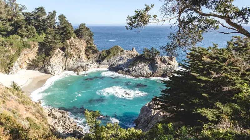
This is what you came for. The road climbs and curves along cliffs, with the Pacific far below and the Santa Lucia mountains rising on your left. Take it slowly. The speed limit is low, there are no guardrails in places, and drivers behind you will want to pass. Use the turnouts and let them.
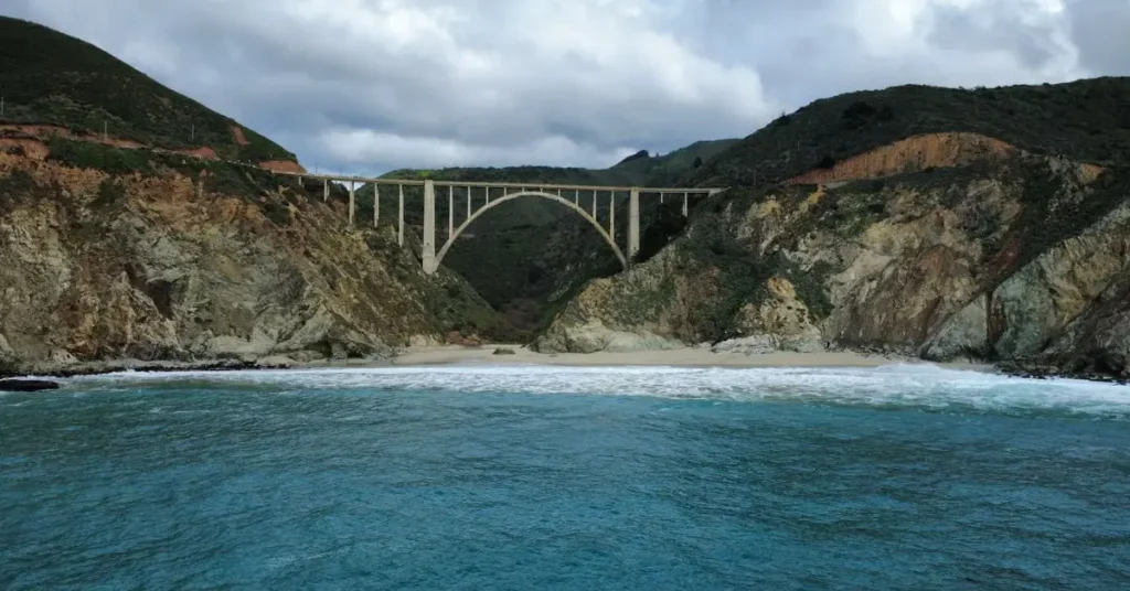
Bixby Creek Bridge is the first big photo stop. It’s a concrete arch roughly 280 feet high, and one of the most photographed bridges on the West Coast. There’s a pullout on the north side. Don’t stand in the road to get your shot.
Point Sur Lighthouse is a few miles on. It sits on a volcanic rock and you can visit on a guided tour. It’s one of the better stops if you want something beyond the views.
Pfeiffer Big Sur State Park gives you redwoods, short hikes, and a break from the cliffs. Day use costs around $10, and the same ticket may cover Julia Pfeiffer Burns State Park on the same day.
McWay Falls is the one to read about before you go. It’s an 80-foot waterfall that drops straight onto a beach. Normally you walk a short, easy path to an overlook. But the overlook trail at Julia Pfeiffer Burns State Park has been closed for a long-term retaining wall repair since April 2025. The last official update I found, from March 2026, still showed it closed. You can still see the falls from a small viewing area on the side of Highway 1, but you won’t get the full overlook. Before you plan your day around it, check the California State Parks page for the current status. And don’t climb past the fences. The cliffs are dangerous, and trespassing in the closed areas can get you cited.
Ragged Point, San Simeon, And Hearst Castle
South of Big Sur, the road opens out and the hills turn golden. Ragged Point is a classic viewpoint. Then comes the Piedras Blancas elephant seal rookery, a free roadside stop where hundreds of seals lie on the beach. It’s windy, loud, and a bit smelly. Kids and adults both love it.
Hearst Castle is the other big attraction. Newspaper tycoon William Randolph Hearst built it, and architect Julia Morgan designed it. You can’t just walk in. Entry is by guided tour only, and tours run roughly $30 to $47 for adults depending on the type. The popular Grand Rooms tour takes about an hour. Book ahead, especially on summer weekends. The official Hearst Castle site has the schedule.
Cambria, Morro Bay, And San Luis Obispo
Cambria is a pretty little village and a good overnight stop. Morro Bay has the giant Morro Rock and a harbor where you can watch sea otters. San Luis Obispo has a lively downtown and the quirky pink Madonna Inn if you want a hotel with personality. Pismo Beach is a laid-back surf town with clam chowder and a pier.
Santa Barbara And Malibu
Highway 1 joins the faster US 101 for a stretch around here, and the drive gets easier. Santa Barbara is the reward at the end of a long day. Think red-tile roofs, Stearns Wharf, wine tasting, and mild evenings. From there, it’s about an hour and 45 minutes to Los Angeles. If you want a final coastal stretch, Malibu is the finish line. Allow extra time. Southern California traffic can undo your relaxed mood in minutes.
A Sample Five-Day Itinerary
- Day 1. San Francisco to Monterey or Carmel. Half Moon Bay and Santa Cruz on the way. Aquarium or 17-Mile Drive in the afternoon.
- Day 2. Monterey to Big Sur. Bixby Bridge, Point Sur, Pfeiffer Big Sur State Park, and the McWay Falls roadside view. Stay near Big Sur and take the evening slowly.
- Day 3. Big Sur to Cambria. Ragged Point, the elephant seals, and a Hearst Castle tour. Dinner in Cambria.
- Day 4. Cambria to Santa Barbara. Morro Bay in the morning, San Luis Obispo or Pismo Beach for lunch, and the Santa Barbara waterfront by evening.
- Day 5. Santa Barbara to Los Angeles, via Malibu. Return the car, or carry on.
If you only have three days, merge days 2 and 3 and skip Santa Cruz and Morro Bay.
What It Costs
The drive itself is cheap. The extras add up.
- Tolls: none on Highway 1. The Golden Gate Bridge has an electronic toll if you drive into San Francisco, so check current rates if you plan to loop back through the city.
- State parks: about $10 per vehicle for day use at most of the Big Sur parks.
- 17-Mile Drive: roughly $12 to $15 per car.
- Hearst Castle: about $30 to $47 per adult.
- Monterey Bay Aquarium: about $35 to $50.
- Gas: more expensive in Big Sur than in the cities. Fill up before you go in.
- Hotels: the big cost. Big Sur lodges are pricey and sell out early. Cambria, San Luis Obispo, and Santa Barbara are easier on the budget.
- One-way rental: picking up in San Francisco and dropping in Los Angeles usually comes with a drop-off fee. Compare companies and check the total price before you book.
Practical Tips That Save Your Trip
Book Big Sur lodging first. There aren’t many rooms, and they fill quickly. If you can’t find one, stay in Carmel or Cambria and day-trip in. Don’t wing it.
Camp only in designated campsites. Monterey County raised the fine for illegal camping to $1,000. That includes roadside pullouts along Highway 1. It’s about wildfire risk, and they enforce it.
Fill up and download maps. Fuel is limited in Big Sur, and mobile signal is patchy. Download offline maps for the whole route and keep a full tank. Don’t let it drop below a quarter.
Start early. Fog burns off by late morning, parking is easier before 9am, and you avoid the afternoon traffic.
Pull fully off the road to take photos. Rental cars stopped on bends cause accidents here. Use the turnouts.
Expect motion sickness. The road twists a lot. If anyone in your group is prone to it, plan breaks and keep the windows open.
EV drivers, plan charging. Chargers are sparse in Big Sur itself. Charge fully in Monterey or Carmel before heading south, and again in Cambria. Check charger locations before you commit to an electric rental.
Visiting From Abroad
This is a great road trip for international visitors, but a few things need sorting before you land. You’ll need the right entry permission for the US. Travellers from visa-waiver countries usually apply for an ESTA online, which currently costs about $40. Others need a visitor visa, and interview wait times can be long. Our US visa guide explains how that works. Apply well before you book non-refundable flights.
For driving, carry your home driver’s licence. If it isn’t in English, take an International Driving Permit too, as rental companies and police may ask for it. Remember that Americans drive on the right. Rental cars are mostly automatic. And roads here use miles and miles per hour.
Planning a longer US trip? Our Miami Beach guide for international tourists is a good next stop for a different kind of coastline.
No Car? Try The Train
Don’t want to drive? Amtrak’s Coast Starlight runs between Los Angeles and Seattle, and parts of it hug the Pacific coast. It doesn’t go through Big Sur, but it gives you a relaxed coastal ride between Southern and Central California. Our Amtrak guide for tourists explains the routes, classes, and what delays to expect.
FAQ
Is Highway 1 open in 2026?
Yes. It reopened end to end on 14 January 2026. Check Caltrans for storm or fire closures before you go.
How many days do you need for the Pacific Coast Highway?
Five days is comfortable. Three is the minimum to enjoy it.
What’s the best direction to drive?
South, from San Francisco to Los Angeles, so the ocean is on your side.
Is McWay Falls open?
The overlook trail has been closed for repairs. You can view the falls from the roadside. Check State Parks first.
When is the best time to go?
Late April to early June, or September to early October.
Are there tolls on the Pacific Coast Highway?
No tolls on Highway 1 itself.No tolls on Highway 1 itself.
Do I need to book Hearst Castle in advance?
Yes, especially for summer weekends. Tours are by ticket only.
Final Thoughts
The Pacific Coast Highway rewards drivers who slow down. The best moments aren’t the famous photo stops. They’re the unplanned ones. A fogbank rolling in over a cliff. A pelican gliding at eye level. A cheap lunch in a town you’d never heard of. Plan your sleep stops, check the road each morning, and leave room in the schedule. Highway 1 is open again, and it’s worth the wait.