
Icefields Parkway Road Trip: Every Stop from Banff to Jasper

There is a moment on the Icefields Parkway – somewhere around Bow Lake or the descent to Mistaya Canyon – when you quietly accept that this road trip has earned every superlative ever applied to it. The Parkway connects Lake Louise and Jasper through 232 kilometers of Canadian Rocky Mountain scenery that the rest of the world has to work considerably harder to match. Turquoise glacial lakes. Ice fields spilling down mountain faces between jagged peaks. Waterfalls appearing at highway pull-offs with the casual confidence of a region that simply has too many waterfalls to be precious about any particular one.
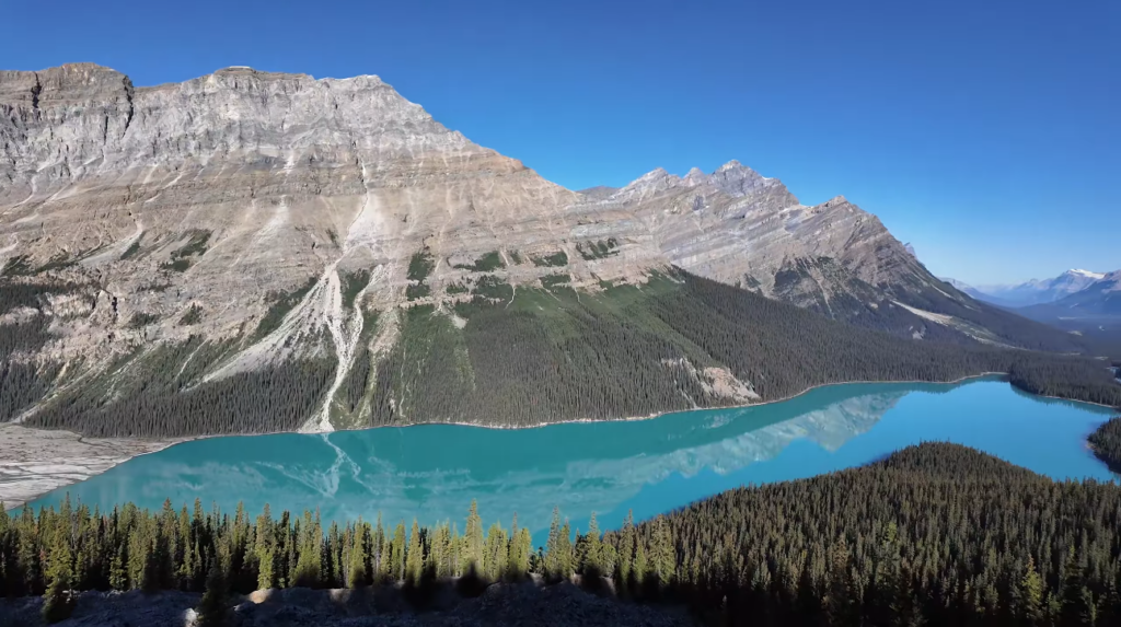
Condé Nast Traveller has consistently rated this one of the most beautiful drives on earth. First-time visitors who arrive expecting this verdict to have been exaggerated consistently report that it has not been. The scenery simply keeps delivering throughout the entire 232 kilometers. There is no weak section.
Quick Facts – Icefields Parkway
- Highway AB-93 North: 232 km Lake Louise to Jasper – total Banff to Jasper approximately 288 km
- Pure driving time: 4 hours – allow 6–8 hours with stops, or 2 full days to see everything properly
- Rated one of the most beautiful drives in the world by Condé Nast Traveller – consistently, every year
- Parks Canada pass required for both Banff and Jasper National Parks – buy at gate or online
- Saskatchewan River Crossing: last fuel before Jasper – overpriced. Fill up in Lake Louise instead
- Columbia Icefield Ice Explorer: book well in advance – summer slots sell out weeks ahead
- Glacier Skywalk: glass-floor platform 918 feet above the valley – book as package with Ice Explorer
- Best season: mid-June through September – outside this window risk of storms and road closures
Before You Drive – Practical Essentials
A Parks Canada Discovery Pass is required for both Banff and Jasper National Parks. Buy at the park gate or in advance online. The Discovery Pass covers unlimited entries for a calendar year and is excellent value for any multi-day Canadian Rockies visit.
Download Google Maps offline for the full Parkway route before you leave mobile signal, which becomes unreliable through significant sections. Fuel is available in Lake Louise (fill up here before starting), at the Saskatchewan River Crossing midway (significantly overpriced – avoid if possible), and in Jasper town at the northern end. There is nothing in between. Fill up in Lake Louise. This is not optional advice.
Stop 1 – Bow Lake and Crowfoot Glacier
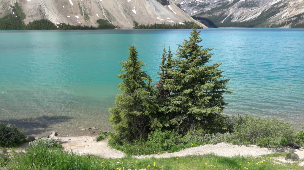
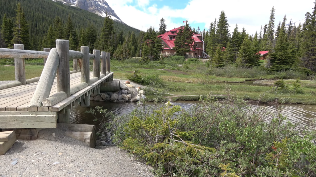
Bow Lake is the Parkway’s first major viewpoint past Lake Louise and a proper introduction to what the next 200 kilometers deliver. The lake is one of the largest in Banff National Park, and the colour – glacial rock flour suspended in the water – is that characteristic Rockies turquoise that you will photograph repeatedly and that photographs still fail to fully capture. The Num-Ti-Jah Lodge on the northern shore, built in the 1920s by mountain guide Jimmy Simpson, adds historical charm.
Just before Bow Lake, the Crowfoot Glacier viewpoint shows a glacier that was named for its three-lobe shape resembling a bird’s foot. Two of the three lobes have since melted. The Parks Canada signboards show historical photographs illustrating the change. It is visually striking and worth five minutes to properly understand what you are seeing.
Stop 2 – Peyto Lake (Do Not Skip This)
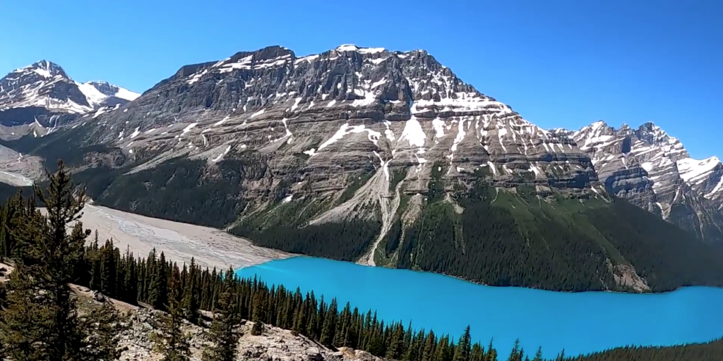
If you could stop only once on the entire Icefields Parkway, it would be Peyto Lake. The viewpoint is reached via a short but steep trail from the Bow Summit car park – about 800 meters one way, gaining around 100 meters of elevation. The effort is completely justified. From the platform, Peyto Lake reveals itself in a wolf-head shape, surrounded by forest and mountains, in a turquoise so vivid it seems artificially enhanced. It is not. It is glacial flour in the water refracting light.
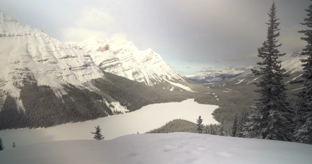
Arrive early morning for the best light and to beat summer crowds that make the car park chaotic by mid-morning. The trail takes 15–20 minutes each way. The Bow Summit viewpoint at 2,088 meters is the highest paved point on the entire Parkway.
Stops 3 and 4 – Waterfowl Lakes and Mistaya Canyon
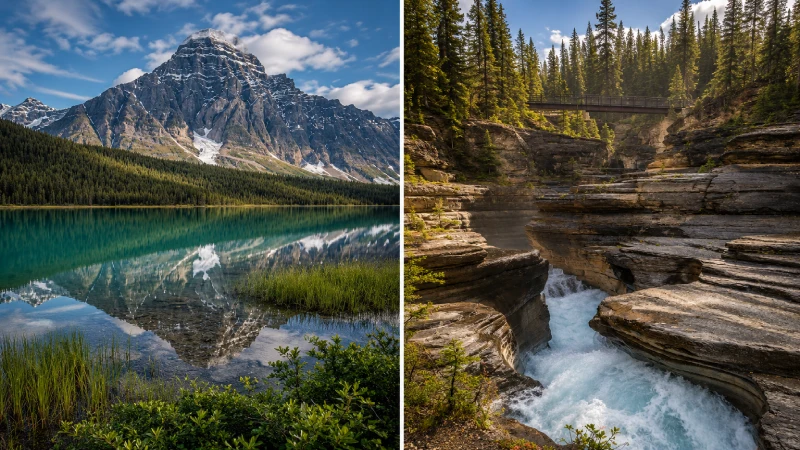
Waterfowl Lakes appears as a pair of connected aqua-colored lakes beside the highway, around 50 kilometers from Lake Louise. The viewpoint is easily reached from the road, and the color of the upper lake with mountain reflections is one of those impromptu shots that turn into a trip highlight.
Mistaya Canyon, a short distance further, is accessed via a 1-kilometer trail from the highway. The Mistaya River has carved a narrow, dramatic canyon through limestone, and the bridge at the bottom gives views of roaring water cutting through channels no wider than a meter at some points. The whole hike takes 20–30 minutes and delivers disproportionate drama for the effort.
Stop 5 – Columbia Icefield and Athabasca Glacier
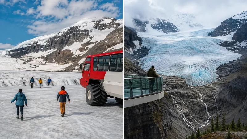
The Columbia Icefield is the largest ice field in the Rocky Mountains south of Alaska – roughly 325 square kilometers at high elevation. The Icefield Centre on the Parkway is the base for two activities that define this stop.
The Ice Explorer tour drives massive specialized vehicles out onto the Athabasca Glacier surface, where you step out and walk on 10,000-year-old ice. The depth beneath your feet at the measurement point is approximately 300 meters. Book in advance – summer tours sell out. You can walk to the base of the glacier from the car park for free if you prefer not to pay for the tour; the visual impact of standing at the glacier edge is significant either way.
The Glacier Skywalk is a glass-floored platform cantilevered over the Sunwapta Valley, 918 feet above the valley floor. Booking it as a package with the Ice Explorer saves money. The views from the platform looking down into the valley and across to the mountain faces are genuinely extraordinary.
| Stop | From Lake Louise | Key Experience | Time | Book Ahead? |
|---|---|---|---|---|
| Bow Lake + Crowfoot Glacier | 32 km | Turquoise lake, glacial retreat history | 45 mins | No |
| Peyto Lake (Bow Summit) | 40 km | Wolf-head turquoise lake – unmissable | 1–1.5 hours | No, arrive before 9am |
| Waterfowl Lakes | 57 km | Double aqua lake roadside viewpoint | 20 mins | No |
| Mistaya Canyon | 72 km | Limestone canyon carved by river | 30–45 mins | No |
| Saskatchewan River Crossing | 100 km | Three rivers meet – fuel if desperate | 15 mins | No |
| Columbia Icefield + Glacier | 125 km | Ice Explorer, Glacier Skywalk | 2–4 hours | YES – essential |
| Sunwapta Falls | 171 km | Upper falls roadside, lower Falls 3 km hike | 45 mins | No |
| Athabasca Falls | 200 km | Most powerful falls on the Parkway | 45 mins | No |
Stops 6 and 7 – Sunwapta and Athabasca Falls
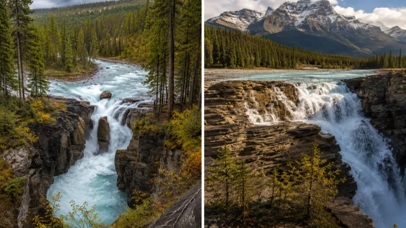
Sunwapta Falls, 46 kilometers from Jasper, drops 18 meters in two stages. The upper falls are visible from the car park – a 100-meter walk. The lower falls require a 3.2-kilometer hike and are, according to most people who make the effort, more impressive than the upper section. A restaurant and lodge operate at the falls in peak season.
Athabasca Falls, 30 kilometers from Jasper, are the most powerful falls on the entire Parkway. The falls drop 23 meters across a 25-meter width, and the roar is audible from the car park. Multiple viewpoints give different perspectives. The canyon views downstream from the main falls are particularly dramatic. Allow 45 minutes.
Also Read – Canada with Toddlers: Best Destinations and Practical Travel Tips.
Final Thoughts
The Icefields Parkway is one of those road trips that changes how you understand the word beautiful. It delivers on the superlatives consistently applied to it. This is not a case of marketing outpacing reality. The scenery between Lake Louise and Jasper is genuinely that extraordinary for the full 232 kilometres – not just at the headline stops. The practical keys: allow two days rather than one, fill up fuel in Lake Louise, book the Ice Explorer in advance, and download offline maps before losing phone coverage.
Wildlife sightings – bears, elk, mountain goats, and bighorn sheep – are common along the Parkway. Always observe from a safe distance and never approach any animal. The best conditions are mid-June through September. Outside this window, storms, ice, and avalanche risk can close sections without warning. Check Parks Canada road condition reports before departing outside peak season, and factor in the Jasper wildfire recovery areas when planning routes near town.
Frequently Asked Questions
How long does the Icefields Parkway drive take?
4 hours of pure driving. A day trip with main stops takes 6–8 hours. Two full days is recommended if you want to see everything without rushing.
Do I need a Parks Canada pass?
Yes, for both Banff and Jasper National Parks. Buy at the gate or online. The Discovery Pass covers unlimited entries for a year and is good value for any extended Rockies visit.
Where can I get fuel on the Parkway?
Lake Louise (fill up here), Saskatchewan River Crossing midway (overpriced – only if genuinely needed), and Jasper town. There is nothing else. Fill in Lake Louise.
Is the Ice Explorer worth the cost?
Yes for most visitors – walking on 10,000-year-old glacier ice 300 meters deep is genuinely unlike anything else. Book in advance. Alternatively, walk to the glacier base from the car park for free.
Best time for the Icefields Parkway?
Mid-June through September. May has potential road closures from snow. October brings spectacular colour but increasing snow risk at higher elevations.

The stops along the Icefields Parkway sound pretty scenic. Did you get to see any wildlife up close?
yes